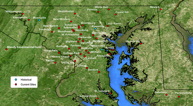
Skip all navigation and jump to content Jump to site navigation Jump to section navigation.
NASA Logo - Goddard Space Flight Center + Visit NASA.gov
HoneyBeeNet banner image
ABOUT SCALE HIVES HONEYBEES SITE DATA NEWS LINKS


Mid-Atlantic Regional Scale Hive Location Map

The HoneyBeeNet scale hive data and maps are updated as needed.  Not all of the regional participants inidicated on the map were able to obtain scales for their hives in time to measure the 2007 nectar flow.  Sites with data are listed in the 'Scale Hive Sites' pull-down menu below, and more will be added as the data become available. 

The sites indicated in blue are historical (before 1982, at the beginning of the satellite record),those in red are current sites (1983 and later), and the yellow sites are new scale hives, collecting nectar flow data in 2008.

Use the button menu above or click on the site map below to see available data and information for a site.
ETM+ of the Middle Atlantic Region Accokeek Fairfax New Windsor Church Hill Great Falls Fairland W.Friendship Clarksville Eldersburg Site Sykesville Site Woodbine Site Lanham Site College Park Site Mt. Airy Site Catonsville Site Halethorpe Site Millersville Site Arnold Site Pikesville Site Forrest Hill Site Columbia Site Laurel Site Highland Site Brookville Site Beltsville Site Somerset Site Chevy Chase Site Queenstown Site Dunkirk Site New Market Site Westminster Site Meyersville Site

FirstGov logo + Privacy Policy and Important Notices NASA Curator: Jaime Nickeson
NASA Official: Wayne Esaias
Last Updated: June 17, 2008